The study area of HANSEL is south-central Chile (between 33.8° and 39.8° latitude South), including regions VI to IX. However, several tasks will cover the whole conterminous Chile.
The specific study area covers a total surfaceof 117.312 km2 and comprises the catchments of seven main rivers draining from the Andes to the Pacific Ocean together with 19 other minor coastal catchments.
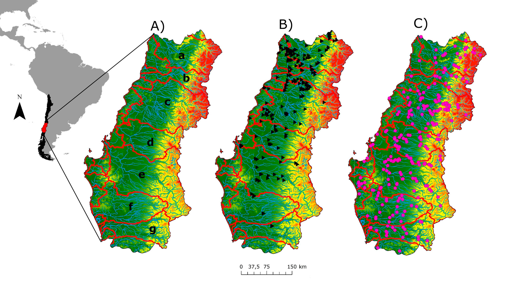
General location of the study area A) Location of the 7 main catchments and rivers in blue (a: Rapel; b: Mataquito; c: Maule; d: Itata; e: Bio-Bio; f: Imperial; g: Tolten). B) Location of 188 reservoirs (black triangles) C) Location of 276 gauge stations (pink circles)..
To achieve the specific goals, the proyect has the four tasks.
Task 1. Development of virtual watersheds and integration of hydrological information
Subtask 1.1. River networks extraction from Digital Elevation Models and calculation of river network variables
Subtask 1.2. Compilation and integration of hydrological and environmental information within the virtual watershed.
Task 2. Characterization and prediction of the natural flow regimes
Subtask 2.1. Development of an inductive hydrological classification
Subtask 2.2. Prediction of target hydrological indices for the whole river network
Task 3. Assessing Hydrologic Alteration
Subtask 3.1. Application of the Hydrologic Alteration Assessment protocol
Subtask 3.2. Construction and analysis of HA gradients and analysis of main factors
Task 4. Determining effects of HA on river functioning
Subtask 4.1. Creation of a control-impact design to conduct a field survey
Subtask 4.2. Analysis of the effects of HA on ecosystem metabolism.
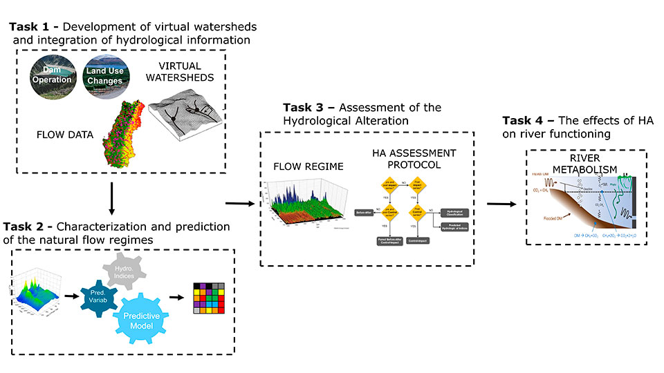
Flow diagram indicating the key parts and work flow of this proposal